schema <-"public"d_dataset_atl <-tibble(ds_key ="nc_atl_birds_dens",response_type ="density", # ds_key: "{src}-{rgn}-{taxa}-{resp}"; see below for response_type, taxa_groups lookups# name_short: "{source_broad} {regions} {taxa_groups} {response_type}"name_short ="NCCOS Atlantic Seabird Densities", name_full ="NCCOS Assessment: Modeling At-Sea Density of Marine Birds to Support Atlantic Marine Renewable Energy Planning from 1978-2016 (NCEI Accession 0176682)",link ="https://www.ncei.noaa.gov/access/metadata/landing-page/bin/iso?id=gov.noaa.nodc:0176682",citation ="Winship, Arliss J.; Kinlan, Brian P.; White, Timothy P.; Leirness, Jeffery B.; Christensen, John (2018). NCCOS Assessment: Modeling At-Sea Density of Marine Birds to Support Atlantic Marine Renewable Energy Planning from 1978-2016 (NCEI Accession 0176682). [indicate subset used]. NOAA National Centers for Environmental Information. Dataset. https://doi.org/10.25921/8eq5-q834. Accessed October 6, 2022.",description ="This dataset provides seasonal spatial rasters of predicted long-term (1980-2017) density of 33 individual species and 13 taxonomic groups of marine birds throughout the Pacific Outer Continental Shelf (OCS) and adjacent waters off the contiguous United States at 2-km spatial resolution. Two indications of the uncertainty associated with the model predictions are also provided: 1) seasonal spatial layers indicating areas with no survey effort and 2) seasonal spatial rasters of the precision of predicted density of each species/group characterized as its coefficient of variation (CV). Predicted density should always be considered in conjunction with these two indications of uncertainty. This dataset also includes spatial rasters of environmental predictor variables that were used in the predictive modeling.",# response_type: one of: occurrence [occs], range [rng], suitability [suit], probability [pr], biomass [m], density [dens], abundance [n]# taxa_groups: one or more of: fish [fish], invertebrates [inverts], marine mammals [marmams], cetaceans [cets], sea turtles [turtles], seabirds [birds], etc.taxa_groups ="seabirds", year_pub =2018,date_obs_beg ="1980-01-01", date_obs_end ="2016-10-05", # up to, but not including *_enddate_env_beg ="1992-01-01", date_env_end ="2018-01-01", # up to, but not including *_endregions =list("Atlantic")) # arrayd_dataset_pac <-tibble(ds_key ="nc_pac_birds_dens",response_type ="density", # ds_key: "{src}-{rgn}-{taxa}-{resp}"; see below for response_type, taxa_groups lookups# name_short: "{source_broad} {regions} {taxa_groups} {response_type}"name_short ="NCCOS Pacific Seabird Densities", name_full ="NCCOS Assessment: Modeling at-sea density of marine birds to support renewable energy planning on the Pacific Outer Continental Shelf of the contiguous United States (NCEI Accession 0242882)",link ="https://www.ncei.noaa.gov/access/metadata/landing-page/bin/iso?id=gov.noaa.nodc:0242882",citation ="Leirness, Jeffery B.; Adams, Josh; Ballance, Lisa T.; Coyne, Michael; Felis, Jonathan J.; Joyce, Trevor; Pereksta, David M.; Winship, Arliss J. (2022). NCCOS Assessment: Modeling at-sea density of marine birds to support renewable energy planning on the Pacific Outer Continental Shelf of the contiguous United States (NCEI Accession 0242882). [indicate subset used]. NOAA National Centers for Environmental Information. Dataset. https://doi.org/10.25921/xqf2-r853. Accessed October 6, 2022.",description ="This dataset provides seasonal spatial rasters of predicted long-term (1980-2017) density of 33 individual species and 13 taxonomic groups of marine birds throughout the Pacific Outer Continental Shelf (OCS) and adjacent waters off the contiguous United States at 2-km spatial resolution. Two indications of the uncertainty associated with the model predictions are also provided: 1) seasonal spatial layers indicating areas with no survey effort and 2) seasonal spatial rasters of the precision of predicted density of each species/group characterized as its coefficient of variation (CV). Predicted density should always be considered in conjunction with these two indications of uncertainty. This dataset also includes spatial rasters of environmental predictor variables that were used in the predictive modeling.",# response_type: one of: occurrence [occs], range [rng], suitability [suit], probability [pr], biomass [m], density [dens], abundance [n]# taxa_groups: one or more of: fish [fish], invertebrates [inverts], marine mammals [marmams], cetaceans [cets], sea turtles [turtles], seabirds [birds], etc.taxa_groups ="seabirds", year_pub =2022,date_obs_beg ="1978-01-01",date_obs_end ="2017-01-01", # up to, but not including *_enddate_env_beg ="1981-01-01", date_env_end ="2017-01-01", # up to, but not including *_endregions =list("Pacific")) # arrayd_datasets <-bind_rows(d_dataset_atl, d_dataset_pac)# check: View(d_datasets); write_csv(d_datasets, "data/nc_datasets.csv"); glimpse(d_datasets)# names(d_dataset) |> paste(collapse = ", ") |> cat()t_datasets <-Id(schema = schema, table ="sdm_datasets")row_exists <-tbl(con, t_datasets) |>filter(ds_key %in%!!d_datasets$ds_key) |>collect() |>nrow() ==length(d_datasets$ds_key)if (!row_exists){# append, except array columns: regionsdbWriteTable( con, t_datasets, append = T, d_datasets |>select(-regions) )for (i in1:nrow(d_datasets)){ # i=1# append array column: regions regions_sql <-glue("ARRAY['{d_datasets$regions[[i]] |> unlist() |> paste(collapse = ', ')}']")dbExecute( con, glue("UPDATE sdm_datasets SET regions = {regions_sql} WHERE ds_key = '{d_datasets$ds_key[[i]]}'") ) }}if (F){ # run once for quick fixdbExecute(con, glue("UPDATE sdm_datasets SET spatial_data_type = 'raster'"))dbExecute(con, glue("UPDATE sdm_datasets SET spatial_data_type = 'vector' WHERE ds_key = 'gm'") )}tbl(con, t_datasets) |>filter(ds_key %in%!!d_datasets$ds_key) |>collect() |>glimpse()
Leirness, J. B., Josh Adams, Lisa T. Ballance, Michael Coyne, Jonathan J. Felis, Trevor Joyce, David M. Pereksta, Arliss J. Winship, Christopher FG Jeffrey, and D. Ainley. 2021. “Modeling at-Sea Density of Marine Birds to Support Renewable Energy Planning on the Pacific Outer Continental Shelf of the Contiguous United States.”https://repository.library.noaa.gov/view/noaa/49073.
Winship, Arliss J., Brian Patrick Kinlan, Timothy Paul White, Jeffrey Leirness, and John Christensen. 2018. “Modeling at-Sea Density of Marine Birds to Support Atlantic Marine Renewable Energy Planning.”
Source Code
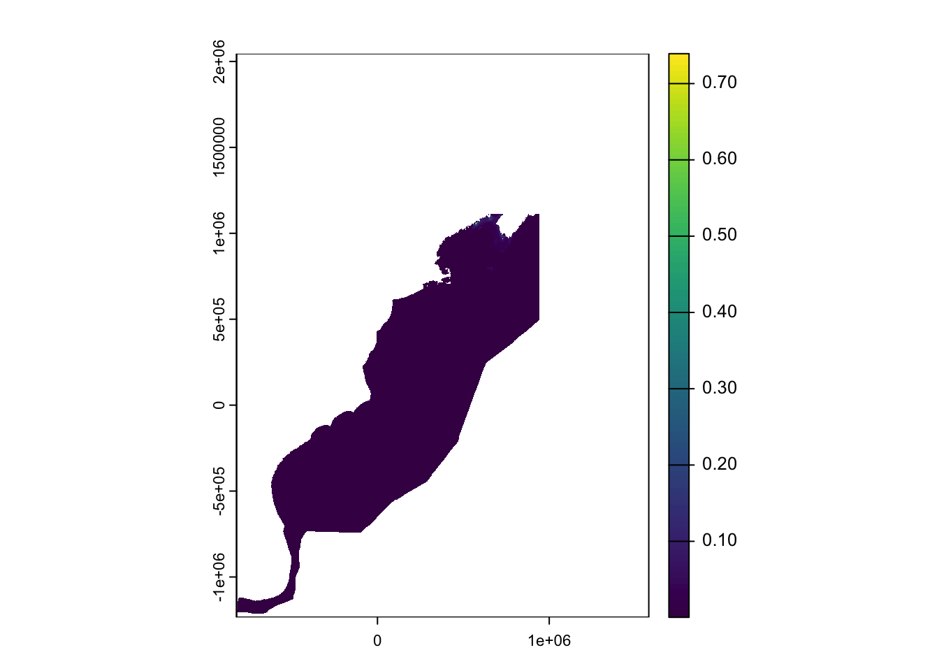
---title: "Ingest SDMs: NCCOS Atlantic & Pacific Seabird Densities"editor_options: chunk_output_type: consoleformat: html: code-fold: true code-tools: true---NCCOS Atlantic & Pacific Seabird Densities [@winship2018; @leirness2021]NCCOS Assessments: Modeling At-Sea Density of Marine Birds for Atlantic and Pacific- Atlantic [NCCOS Assessment: Modeling At-Sea Density of Marine Birds to Support Atlantic Marine Renewable Energy Planning from 1978-2016 (NCEI Accession 0176682)](https://www.ncei.noaa.gov/access/metadata/landing-page/bin/iso?id=gov.noaa.nodc:0176682)- Pacific: [NCCOS Assessment: Modeling at-sea density of marine birds to support renewable energy planning on the Pacific Outer Continental Shelf of the contiguous United States (NCEI Accession 0242882)](https://www.ncei.noaa.gov/access/metadata/landing-page/bin/iso?id=gov.noaa.nodc:0242882)```/Users/bbest/My Drive/projects/_archive/offhab/data/raw/ncei.noaa.gov - seabirds, atlantic/- 0176682/1.1/data/0-data/NCCOS-Atlantic-Birds_ArchiveDataPackage/NCCOS-Atlantic-Birds_ArchiveDataPackage/Documentation/ - Atlantic_bird_mapping_data_documentation.pdf - atl_spp.xlsxncei.noaa.gov - seabirds, pacific/- 0242882/1.1/data/1-data/4LFC6T_PacificBirds_NCCOS/ - DataDocumentation.pdf - pac_spp.xlsx``````{r}#| messages: FALSE#| warning: FALSE# packageslibrarian::shelf(# devtools, dplyr, DT, fs, gdalUtilities, glue, here, httr2, janitor, jsonlite, knitr, mapview, purrr, readr, readxl, sf, stringr, terra, tibble, tidyr, units,quiet = T)options(readr.show_col_types = F)source(here("libs/db.R")) # con, create_index()``````{r d_datasets}schema <- "public"d_dataset_atl <- tibble( ds_key = "nc_atl_birds_dens", response_type = "density", # ds_key: "{src}-{rgn}-{taxa}-{resp}"; see below for response_type, taxa_groups lookups # name_short: "{source_broad} {regions} {taxa_groups} {response_type}" name_short = "NCCOS Atlantic Seabird Densities", name_full = "NCCOS Assessment: Modeling At-Sea Density of Marine Birds to Support Atlantic Marine Renewable Energy Planning from 1978-2016 (NCEI Accession 0176682)", link = "https://www.ncei.noaa.gov/access/metadata/landing-page/bin/iso?id=gov.noaa.nodc:0176682", citation = "Winship, Arliss J.; Kinlan, Brian P.; White, Timothy P.; Leirness, Jeffery B.; Christensen, John (2018). NCCOS Assessment: Modeling At-Sea Density of Marine Birds to Support Atlantic Marine Renewable Energy Planning from 1978-2016 (NCEI Accession 0176682). [indicate subset used]. NOAA National Centers for Environmental Information. Dataset. https://doi.org/10.25921/8eq5-q834. Accessed October 6, 2022.", description = "This dataset provides seasonal spatial rasters of predicted long-term (1980-2017) density of 33 individual species and 13 taxonomic groups of marine birds throughout the Pacific Outer Continental Shelf (OCS) and adjacent waters off the contiguous United States at 2-km spatial resolution. Two indications of the uncertainty associated with the model predictions are also provided: 1) seasonal spatial layers indicating areas with no survey effort and 2) seasonal spatial rasters of the precision of predicted density of each species/group characterized as its coefficient of variation (CV). Predicted density should always be considered in conjunction with these two indications of uncertainty. This dataset also includes spatial rasters of environmental predictor variables that were used in the predictive modeling.", # response_type: one of: occurrence [occs], range [rng], suitability [suit], probability [pr], biomass [m], density [dens], abundance [n] # taxa_groups: one or more of: fish [fish], invertebrates [inverts], marine mammals [marmams], cetaceans [cets], sea turtles [turtles], seabirds [birds], etc. taxa_groups = "seabirds", year_pub = 2018, date_obs_beg = "1980-01-01", date_obs_end = "2016-10-05", # up to, but not including *_end date_env_beg = "1992-01-01", date_env_end = "2018-01-01", # up to, but not including *_end regions = list("Atlantic")) # arrayd_dataset_pac <- tibble( ds_key = "nc_pac_birds_dens", response_type = "density", # ds_key: "{src}-{rgn}-{taxa}-{resp}"; see below for response_type, taxa_groups lookups # name_short: "{source_broad} {regions} {taxa_groups} {response_type}" name_short = "NCCOS Pacific Seabird Densities", name_full = "NCCOS Assessment: Modeling at-sea density of marine birds to support renewable energy planning on the Pacific Outer Continental Shelf of the contiguous United States (NCEI Accession 0242882)", link = "https://www.ncei.noaa.gov/access/metadata/landing-page/bin/iso?id=gov.noaa.nodc:0242882", citation = "Leirness, Jeffery B.; Adams, Josh; Ballance, Lisa T.; Coyne, Michael; Felis, Jonathan J.; Joyce, Trevor; Pereksta, David M.; Winship, Arliss J. (2022). NCCOS Assessment: Modeling at-sea density of marine birds to support renewable energy planning on the Pacific Outer Continental Shelf of the contiguous United States (NCEI Accession 0242882). [indicate subset used]. NOAA National Centers for Environmental Information. Dataset. https://doi.org/10.25921/xqf2-r853. Accessed October 6, 2022.", description = "This dataset provides seasonal spatial rasters of predicted long-term (1980-2017) density of 33 individual species and 13 taxonomic groups of marine birds throughout the Pacific Outer Continental Shelf (OCS) and adjacent waters off the contiguous United States at 2-km spatial resolution. Two indications of the uncertainty associated with the model predictions are also provided: 1) seasonal spatial layers indicating areas with no survey effort and 2) seasonal spatial rasters of the precision of predicted density of each species/group characterized as its coefficient of variation (CV). Predicted density should always be considered in conjunction with these two indications of uncertainty. This dataset also includes spatial rasters of environmental predictor variables that were used in the predictive modeling.", # response_type: one of: occurrence [occs], range [rng], suitability [suit], probability [pr], biomass [m], density [dens], abundance [n] # taxa_groups: one or more of: fish [fish], invertebrates [inverts], marine mammals [marmams], cetaceans [cets], sea turtles [turtles], seabirds [birds], etc. taxa_groups = "seabirds", year_pub = 2022, date_obs_beg = "1978-01-01", date_obs_end = "2017-01-01", # up to, but not including *_end date_env_beg = "1981-01-01", date_env_end = "2017-01-01", # up to, but not including *_end regions = list("Pacific")) # arrayd_datasets <- bind_rows(d_dataset_atl, d_dataset_pac)# check: View(d_datasets); write_csv(d_datasets, "data/nc_datasets.csv"); glimpse(d_datasets)# names(d_dataset) |> paste(collapse = ", ") |> cat()t_datasets <- Id(schema = schema, table = "sdm_datasets")row_exists <- tbl(con, t_datasets) |> filter(ds_key %in% !!d_datasets$ds_key) |> collect() |> nrow() == length(d_datasets$ds_key)if (!row_exists){ # append, except array columns: regions dbWriteTable( con, t_datasets, append = T, d_datasets |> select(-regions) ) for (i in 1:nrow(d_datasets)){ # i=1 # append array column: regions regions_sql <- glue( "ARRAY['{d_datasets$regions[[i]] |> unlist() |> paste(collapse = ', ')}']") dbExecute( con, glue( "UPDATE sdm_datasets SET regions = {regions_sql} WHERE ds_key = '{d_datasets$ds_key[[i]]}'") ) }}if (F){ # run once for quick fix dbExecute(con, glue( "UPDATE sdm_datasets SET spatial_data_type = 'raster'")) dbExecute(con, glue( "UPDATE sdm_datasets SET spatial_data_type = 'vector' WHERE ds_key = 'gm'") )}tbl(con, t_datasets) |> filter(ds_key %in% !!d_datasets$ds_key) |> collect() |> glimpse()``````{r rast}# setup paths ----dir_g <- "/Users/bbest/My Drive/projects/_archive/offhab/data/raw"dir_atl <- glue("{dir_g}/ncei.noaa.gov - seabirds, atlantic/0176682/1.1/data/0-data/NCCOS-Atlantic-Birds_ArchiveDataPackage")dir_pac <- glue("{dir_g}/ncei.noaa.gov - seabirds, pacific/0242882/1.1/data/0-data")spp_atl_xls <- glue("{dir_atl}/Documentation/atl_spp.xlsx")spp_pac_xls <- glue("{dir_pac}/4LFC6T_PacificBirds_NCCOS/pac_spp.xlsx")# get Atlantic rasters ----dir_atl_tif <- glue("{dir_atl}/Data/model_output_predictions")rx_atl <- "(.+)_(.+)_predicted_relative_density_bootstrap_(.+)\\.tif$"d_atl <- tibble( path_tif = list.files(dir_atl_tif, rx_atl, full.names = T, recursive = T)) |> mutate( file_tif = basename(path_tif), region = "Atlantic", sp_code = str_replace(file_tif, rx_atl, "\\1"), season = str_replace(file_tif, rx_atl, "\\2"), var = str_replace(file_tif, rx_atl, "\\3"))# d_atl |> select(-path_tif) |> glimpse()# Rows: 420# Columns: 5# $ file_tif <chr> "ATPU_fall_predicted_relative_density_bootstrap_CV.tif", "ATPU_fall_predicted_relative_den…# $ region <chr> "Atlantic", "Atlantic", "Atlantic", "Atlantic", "Atlantic", "Atlantic", "Atlantic", "Atlan…# $ sp_code <chr> "ATPU", "ATPU", "ATPU", "AUSH", "AUSH", "AUSH", "BCPE", "BCPE", "BCPE", "BLKI", "BLKI", "B…# $ season <chr> "fall", "fall", "fall", "fall", "fall", "fall", "fall", "fall", "fall", "fall", "fall", "f…# $ var <chr> "CV", "QUANT_50", "RANGE_CI90", "CV", "QUANT_50", "RANGE_CI90", "CV", "QUANT_50", "RANGE_C…# check all tifs: fs::dir_ls(dir_atl_tif, glob="*.tif", recursive=T) |> length()# get Pacific rasters ----dir_pac_tif <- glue("{dir_pac}/model_output_predictions")rx_pac <- "(.+)_(.+)_predicted_(.*).tif$"d_pac <- tibble( path_tif = list.files(dir_pac_tif, rx_pac, full.names = T, recursive = T)) |> mutate( file_tif = basename(path_tif), region = "Pacific", sp_code = str_replace(file_tif, rx_pac, "\\1"), season = str_replace(file_tif, rx_pac, "\\2"), var = str_replace(file_tif, rx_pac, "\\3"))# d_pac |> select(-path_tif) |> glimpse()# Rows: 270# Columns: 5# $ file_tif <chr> "ANMU_spring_predicted_density_CV.tif", "ANMU_spring_predicted_density.tif", "ASSP_fall_pred…# $ region <chr> "Pacific", "Pacific", "Pacific", "Pacific", "Pacific", "Pacific", "Pacific", "Pacific", "Pac…# $ sp_code <chr> "ANMU", "ANMU", "ASSP", "ASSP", "ASSP", "ASSP", "ASSP", "ASSP", "BFAL", "BFAL", "BFAL", "BFA…# $ season <chr> "spring", "spring", "fall", "fall", "spring", "spring", "summer", "summer", "fall", "fall", …# $ var <chr> "density_CV", "density", "density_CV", "density", "density_CV", "density", "density_CV", "de…# check for any missing TIFs: fs::dir_ls(dir_pac_tif, glob="*.tif", recursive=T) |> length()# combine Atlantic and Pacific ----d <- bind_rows( d_atl, d_pac)# run onceif (F){ # read in rasters ---- d <- d |> select(region, sp_code, season, var, path_tif) |> mutate( r = map(path_tif, terra::rast), crs = map_chr(r, crs, proj=T), crs_tr = map_chr(crs, str_trunc, 24), nrow = map_int(r, nrow), ncol = map_int(r, ncol)) |> arrange(region, crs_tr, sp_code, season, var) # confirm same dims per region: d |> select(nrow, ncol, region) |> table() # fix rasters in Atlantic missing crs ---- # unique(d$crs) # [1] "+proj=omerc +lat_0=35 +lonc=-75 +alpha=40 +gamma=40 +k=0.9996 +x_0=0 +y_0=0 +ellps=GRS80 +towgs84=0,0,0,0,0,0,0 +units=m +no_defs" # [2] "" # [3] "+proj=omerc +lat_0=39 +lonc=-125 +alpha=75 +gamma=75 +k=0.9996 +x_0=0 +y_0=0 +datum=WGS84 +units=m +no_defs" # d |> select(crs_tr, region) |> table() # region # crs_tr Atlantic Pacific # 7 0 # +proj=omerc +lat_0=35... 413 0 # +proj=omerc +lat_0=39... 0 270 crs_atl <- d |> filter(region == "Atlantic" & crs != "") |> first() |> pull(crs) d <- d |> mutate( r = map(r, \(x) { if (crs(x) == "") crs(x) <- crs_atl x } ) ) |> select(-crs, -crs_tr, -nrow, -ncol) # write rasters per model (region-species-season), including all vars ---- dir_tif <- here("data/sdm/raw") for (dir_ds in glue("{dir_tif}/{d_datasets$ds_key}")) dir.create(dir_ds, recursive = T, showWarnings = F) # * standardize vars ---- # d |> select(region, var) |> table() # var # region CV density density_CV QUANT_50 RANGE_CI90 # Atlantic 140 0 0 140 140 # Pacific 0 135 135 0 0 d <- d |> mutate( ds_key = case_match( region, "Atlantic" ~ "nc_atl_birds_dens", "Pacific" ~ "nc_pac_birds_dens"), mdl_tif = glue("{dir_tif}/{ds_key}/{sp_code}_{season}.tif"), var = case_match( var, "density" ~ "n_per_km2", "QUANT_50" ~ "n_per_km2", "density_CV" ~ "cv_n_per_km2", "CV" ~ "cv_n_per_km2", "RANGE_CI90" ~ "ci90_n_per_km2") ) d_mdls <- d |> arrange( ds_key, region, sp_code, season, # arrange by var to ensure n_per_km2 (density) is first, cv second factor(var, levels = c("n_per_km2", "cv_n_per_km2", "ci90_n_per_km2"))) |> group_by(ds_key, region, sp_code, season, mdl_tif) |> nest() |> ungroup() # * write out rasters per model, convert to COG ---- d_mdls |> select(data, mdl_tif) |> pwalk(\(data, mdl_tif) { tmp_tif <- tempfile(fileext = ".tif") # if mdl_tif already exists and is a valid COG, skip if (file_exists(mdl_tif)){ is_cog <- system(glue("rio cogeo validate {mdl_tif}"), intern=T) |> str_detect(" is a valid cloud optimized GeoTIFF") if (is_cog) return() file_move(mdl_tif, tmp_tif) } else { r <- rast(data$r) names(r) <- data$var writeRaster(r, file = tmp_tif, overwrite = T) } system(glue("rio cogeo create {tmp_tif} {mdl_tif}")) unlink(tmp_tif) }) # Uploaded all data/sdm/raw/{ds_key}/*.tif to rstudio.marinesensitivity.org:/share/public/cog/sdm/raw/{ds_key}/*.tif # TODO: make COGs (*.tif) into STAC w/ json metadata # * write out temp csv (later db tbl) of all models for shiny app sdm-cog, including band index `bidx` ---- d |> arrange( ds_key, region, sp_code, season, # arrange by var to ensure n_per_km2 (density) is first, cv second factor(var, levels = c("n_per_km2", "cv_n_per_km2", "ci90_n_per_km2"))) |> mutate( cog_url = glue("https://file.marinesensitivity.org/cog/sdm/raw/{ds_key}/{basename(mdl_tif)}"), bidx = factor(var, levels = c("n_per_km2", "cv_n_per_km2", "ci90_n_per_km2")) |> as.integer()) |> select(-r, -path_tif, -mdl_tif) |> relocate(ds_key) |> write_csv(here("data/nc_models.csv")) # check: x |> select(var, bidx) |> table() }# TODO: write d_mdls, d_spp to db # use 'nc_*', not 'gm'## t_mdls <- Id(schema = schema, table = "sdm_models")# rows_exist <- tbl(con, t_mdls) |> filter(ds_key == "gm") |> summarize(n()) |> pull() > 0# if (!rows_exist)# dbWriteTable(con, t_mdls, d_mdls, append = T)# # t_spp <- Id(schema = schema, table = "sdm_species")# rows_exist <- tbl(con, t_spp) |> filter(ds_key == "gm") |> summarize(n()) |> pull() > 0# if (!rows_exist)# dbWriteTable(con, t_spp, d_spp, append = T)# table(d$var, d$region)# Atlantic Pacific# ci90_n_per_km2 140 0# cv_n_per_km2 140 135# n_per_km2 140 135# TODO: Pacific: somehow include survey_effort_mask_{season}.shp# d <- d |> # mutate(# datatype = map_chr(r, datatype))# table(d$datatype, d$region)# FLT8S``````{r map-cog}# map COG ----cog_url = "https://file.marinesensitivity.org/cog/sdm/raw/nc_atl_birds_dens/ARTE_summer.tif"cog_method = "bilinear"cog_palette = "spectral_r"lgnd_palette = "Spectral"lgnd_palette_r = Tbidx = 1# * plot locally ----cog_tif <- str_replace( cog_url, "https://file.marinesensitivity.org/cog/sdm", here("data/sdm"))stopifnot(file.exists(cog_tif))r <- rast(cog_tif, lyrs=bidx)plot(r) # plot native terra# * plot via terra::plet() ----plet( r, col = RColorBrewer::brewer.pal( 11, "Spectral") |> rev(), tiles = "Esri.OceanBasemap")# * plot via leaflet ----library(leaflet)r_mer <- leaflet::projectRasterForLeaflet( r, method = "bilinear")pal <- colorNumeric("Spectral", values(r_mer), na.color = "transparent", reverse = T)leaflet() |> addProviderTiles("Esri.OceanBasemap") |> addRasterImage(r_mer, colors = pal, opacity = 0.8) |> addLegend(pal = pal, values = values(r_mer), title = names(r_mer))# * get bounding box via titiler ----titiler_endpoint = "https://titiler.xyz"cog_bb <- request(titiler_endpoint) |> req_url_path_append("cog", "bounds") |> req_url_query( url = cog_url, bidx = bidx) |> req_perform() |> resp_body_json() |> unlist() |> as.numeric()cog_bb# * get range of values via titiler ----cog_rng <- request(titiler_endpoint) |> req_url_path_append("cog", "statistics") |> req_url_query( url = cog_url, bidx = bidx) |> req_perform() |> resp_body_json() |> pluck(glue("b{bidx}")) |> keep_at(~ .x %in% c("min", "max")) |> as.numeric()cog_rng# set cog_rng manually# cog_rng <- range(values(r, na.rm=T))tile_opts <- glue( "bidx={bidx}&expression=b{bidx}& unscale=false& resampling={cog_method}&reproject={cog_method}&return_mask=true& rescale={paste(cog_rng, collapse=',')}& colormap_name={cog_palette}") |> str_replace_all("\\s+", "")sdm_tile_url <- glue( "{titiler_endpoint}/cog/tiles/WebMercatorQuad/{{z}}/{{x}}/{{y}}@2x.png?url={cog_url}&{tile_opts}")# OLD: https://api.cogeo.xyz/docs#/Cloud%20Optimized%20GeoTIFF/tile_cog_tiles__TileMatrixSetId___z___x___y___scale_x__format__get# # TODO: cogeo.xyz (bidx = 1,2,3) VS titiler.xyz (bidx = List [ 1, 2, 3]) ?## NEW: https://titiler.xyz/api.html#/Cloud%20Optimized%20GeoTIFF/tile_cog_tiles__tileMatrixSetId___z___x___y___scale_x__format__getlibrary(rdeck)dir_private <- switch( Sys.info()[["sysname"]], "Darwin" = "/Users/bbest/My Drive/private", "Linux" = "/share/private")mb_token_txt <- glue("{dir_private}/mapbox_token_bdbest.txt")mb_token <- readLines(mb_token_txt)options(rdeck.mapbox_access_token = mb_token)bb <- cog_bbrdeck( map_style = mapbox_dark(), theme = "light", initial_bounds = st_bbox( c(xmin=bb[1], ymin=bb[2], xmax=bb[3], ymax=bb[4]), crs = st_crs(4326) ) ) |> add_tile_layer( id = "sdm", name = "sdm", # visible = F, # visibility_toggle = T, opacity = 0.5, data = sdm_tile_url)```