### Species feedback
Avery Paxton \- NOAA Federal \<[avery.paxton@noaa.gov](mailto:avery.paxton@noaa.gov)\>:
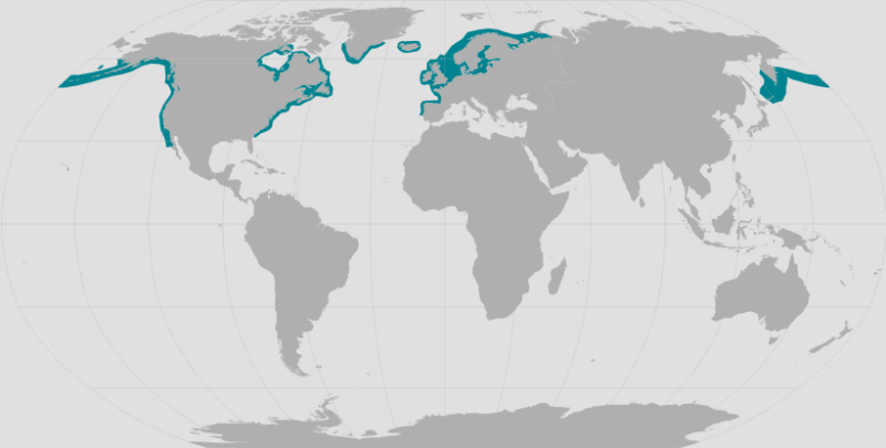
One of my action items was to share the list of other marine mammals that the MST shows as occurring in the Eastern Gulf planning area (that's where we focused our initial review) that don't currently occur there. There were 12 more (13 if include walrus) of 44 marine mammals. Those included (with hyperlinks to the models in case helpful): [*Balaenoptera brydei* (Bryde’s whale)](https://shiny.marinesensitivity.org/mapsp/?mdl_seq=295), [*Balaenoptera edeni* (smaller Indian fin-whale)](https://shiny.marinesensitivity.org/mapsp/?mdl_seq=170), [*Cystophora cristata* (hooded seal)](https://shiny.marinesensitivity.org/mapsp/?mdl_seq=1808), [*Globicephala melas* (round-headed porpoise)](https://shiny.marinesensitivity.org/mapsp/?mdl_seq=1434), [*Halichoerus grypus* (grey seal)](https://shiny.marinesensitivity.org/mapsp/?mdl_seq=4454), [Hyperoodon ampullatus (bottlie)](https://shiny.marinesensitivity.org/mapsp/?mdl_seq=1354), [*Lagenorhynchus albirostris* (white-beaked bottlenose)](https://shiny.marinesensitivity.org/mapsp/?mdl_seq=1679), [*Mesoplodon bidens* (North Atlantic beaked whale)](https://shiny.marinesensitivity.org/mapsp/?mdl_seq=1308), ([*Pagophilus groenlandicus* (harp seal)](https://shiny.marinesensitivity.org/mapsp/?mdl_seq=3246), [*Phoca vitulina* (harbor seal)](https://shiny.marinesensitivity.org/mapsp/?mdl_seq=770), [*Phocoena phocoena* (harbor porpoise)](https://shiny.marinesensitivity.org/mapsp/?mdl_seq=593), and [*Sotalia guianesis* (Guiana dolphin)](https://shiny.marinesensitivity.org/mapsp/?mdl_seq=9013). Hope this helps some.
### Species Approach ✨
Below are concise, actionable items for each species from the meeting—who should do it, what to do, why it matters, and recommended deadlines. I prioritized items discussed in the meeting (IUCN vs ESA handling, range masks, taxonomic issues, visualization/scale changes, and documentation/QA). I kept items short so you can copy them into a task tracker.
General rules to apply across species (do first / reuse):
* Rule A (legal precedence)
Use US ESA listing & Fish & Wildlife spatial products when a US ESA status or spatial footprint exists for the species/subpopulation inside the US EEZ. If explicitly “not listed” by US agencies, override IUCN status for US EEZ and default to suitability-only scoring. (Owner: Tim; implementer: Ben)
* Rule B (non-ESA species)
Where no US ESA listing exists, use IUCN range maps as mask; use suitability models (AquaMaps / SDMs) for score gradients inside that mask. (Owner: Tim; implementer: Ben)
* Rule C (taxonomic/subspecies handling)
Union subspecies into species-level footprint when subspecies distributions exist; use maximum ESA listing across subspecies. Track exceptions in an “exceptions log.” (Owner: Ben to implement; Tim to approve exceptions)
* Rule D (visualization / UI)
Default view \= merged model only (remove display radio buttons for public briefings). Standardize color ramp to 0–100 consistent breaks across species. Document color legend in briefing notes. (Owner: Ben; due: maps-for-briefing deliverable)
* Rule E (traceability \+ QA)
For every species change, add an audit note: source(s) used, any overrides, date, who approved. Keep a CSV of overrides & rationale. (Owner: Ben to generate; Tim to review)
**Deadlines:**
* Minimum maps for briefing (high-level maps for Secretary briefing): due next week (deliver merge-model maps clipped to US EEZ and color-standardized). (Owner: Ben; coordinate with Tim for narrative)
* Decision package / mid-February: have analytical conclusions \+ documented exceptions ready for review. (Owner: Tim; implementer: Ben)
Species-specific action items
#### 1\) Walrus (Odobenus rosmarus)
- [ ] Verify Fish & Wildlife spatial polygon(s) (Pacific/Atlantic subspecies) and import into species database; union subspecies polygons into species-level mask for US EEZ. (Ben)
- [ ] Confirm ESA status in FWS API (listed / candidate / not listed). If explicitly “not listed,” override IUCN for US EEZ and use suitability-only scoring. (Ben)
- [ ] If IUCN lists Vulnerable globally, document how and where IUCN applies (non-US EEZ only). Add audit note explaining override logic. (Ben \+ Tim)
- [ ] Update merge model so minimum value inside walrus mask reflects the override rule (if not listed → no forced minimum). (Ben)
- [ ] Add entry to exceptions log explaining walrus handling and cite sources. (Ben)
- [ ] Deliverable: updated walrus map (merged, color-standardized) \+ audit note. (Due: next week)
#### 2/3) Balaenoptera brydei (Bryde’s whale) /Balaenoptera edeni (smaller Indian/‘Edeni’) — (Rice’s/Bryde’s/Taxonomic confusion)
- [ ] Resolve taxonomy used in datasets: map input source names (AquaMaps, IUCN, NOAA) to canonical scientific names and note synonyms (include Brideyi, Bryde’s, edeni variants). Create alias table. (Ben)
- [ ] For Gulf of Mexico: apply IUCN range mask for Rice’s whale where IUCN indicates Gulf distribution (the “broad BLOB” discussed). Where NOAA critical habitat exists, apply Rule A (use NOAA/FWS critical habitat polygon and align scoring values to match political sensitivity—i.e., map ESA endangered → 100 if decision made). (Ben \+ Tim)
- [ ] Implement a specific rule: equalize IUCN “CR” (critically endangered) with US ESA “endangered” to avoid political misalignment for high-scrutiny species (apply only after Tim approval). Record decision. (Tim to approve; Ben to implement)
- [ ] Create a mask for Gulf-of-Mexico Rice’s whale to exclude bride’s/other subspecies where appropriate; document rationale. (Ben)
- [ ] Deliver: merged map that appears identical to the paper’s continuous layer (single value across suitable/cored areas) for briefing; include explanation of how values were harmonized. (Due: next week)
#### 4\) Cystophora cristata (hooded seal)
- [ ] Verify whether NOAA or FWS manage this species in the US EEZ; check for any ESA critical habitat/subpopulation. (Ben)
- [ ] If not listed (likely), default to suitability-only scoring inside IUCN mask; do not bump to IUCN Vulnerable for US EEZ unless explicit US listing exists. Add audit note that hooded seal is protected under MMPA in US but not ESA-listed (per meeting). (Ben \+ Tim)
- [ ] Ensure merged model clip uses IUCN range to remove spurious Gulf of Mexico occurrences from AquaMaps. (Ben)
- [ ] Deliver: hooded seal merged map \+ audit note. (Due: next week)
#### 5\) Globicephala melas (long-finned pilot whale / round-headed porpoise — verify common name)
- [ ] Correct common name mapping in catalog: ensure scientific name → correct common name (meeting flagged name confusion). (Ben)
- [ ] Apply IUCN mask \+ AquaMaps suitability; if IUCN is Least Concern and no US ESA status, keep suitability gradients and do not force a high minimum. (Ben)
- [ ] Add audit notes and change UI label to standard common name used by NOAA where appropriate. (Ben)
- [ ] Deliver: corrected label \+ merged map. (Due: next week)
* [Globicephala melas distribution (mammal: round-headed porpoise; mdl\\\_seq: 1434\) from AquaMaps SDM | BOEM Marine Sensitivity](https://shiny.marinesensitivity.org/mapsp/?mdl_seq=1434)
#### 6\) Halichoerus grypus (grey seal)
- [ ] Check FWS/NOAA subpopulation and US EEZ spatial boundaries; prefer Fish & Wildlife polygon if it exists for US waters. (Ben)
- [ ] Apply Rule A if US ESA/FWS listing exists for subpopulations; otherwise use IUCN mask and suitability. (Ben)
- [ ] Document any differences between AquaMaps and IUCN; note reason for chosen mask and scoring. (Ben \+ Tim)
- [ ] Deliver: merged map \+ audit note. (Due: next week)
* [Halichoerus grypus distribution (mammal: grey seal; mdl\\\_seq: 21650\) from Merged Model | BOEM Marine Sensitivity](https://shiny.marinesensitivity.org/mapsp/?mdl_seq=21650)
#### 7\) Hyperoodon ampullatus (northern bottlenose whale)
- [ ] Correct common name entry (bottlenose / bottlie typo in meeting). Ensure database common-name consistency. (Ben)
- [ ] Use IUCN range mask; if Duke or other SDM exists with higher confidence, prefer SDM inside US EEZ but clip to IUCN (Rule B) for international ranges. (Ben)
- [ ] Add a note about data sparseness in certain areas (so reviewers understand why model was dropped in places). (Ben)
- [ ] Deliver: merged map \+ documentation of model inputs. (Due: next week)
* [Hyperoodon ampullatus distribution (mammal: bottlie; mdl\\\_seq: 22829\) from Merged Model | BOEM Marine Sensitivity](https://shiny.marinesensitivity.org/mapsp/?mdl_seq=22829)
#### 8\) Lagenorhynchus albirostris (white-beaked dolphin / bottlenose note)
- [ ] Correct common-name mapping (white-beaked / white-beaked bottlenose confusion). (Ben)
- [ ] Clip AquaMaps/SDM to IUCN range; use suitability where no ESA listing. (Ben)
- [ ] Deliver map \+ audit note. (Due: next week)
* [Lagenorhynchus albirostris distribution (mammal: white-beaked bottlenose; mdl\\\_seq: 21663\) from Merged Model | BOEM Marine Sensitivity](https://shiny.marinesensitivity.org/mapsp/?mdl_seq=21663)
#### 9\) Mesoplodon bidens (North Atlantic beaked whale)
- [ ] Check IUCN range, AquaMaps SDM; few observations likely → prefer expert/compiled polygons (Duke / NOAA) if available. (Ben)
- [ ] If Duke provided a polygon, adopt Duke polygon in US EEZ and document why (modeling choice due to low observations). (Ben)
- [ ] Track final cell values: ensure merged model reflects intended minimum/maximum behavior (no misleading low-blue colors where minimum is actually high). (Ben)
- [ ] Deliver: merged map \+ explanatory note about low-sampling uncertainty. (Due: next week)
* [Mesoplodon bidens distribution (mammal: North Atlantic beaked whale; mdl\\\_seq: 1308\) from AquaMaps SDM | BOEM Marine Sensitivity](https://shiny.marinesensitivity.org/mapsp/?mdl_seq=1308)
#### 10\) Pagophilus groenlandicus (harp seal)
- [ ] Use IUCN range mask for global extent; clip to US EEZ. (Ben)
- [ ] If AquaMaps extended into Gulf (erroneous), ensure merge model clip applies and removes Gulf occurrence. (Ben)
- [ ] Document whether MMPA or NOAA management notes apply in US waters. (Ben)
- [ ] Deliver: merged map \+ audit. (Due: next week)
* [Pagophilus groenlandicus distribution (mammal: harp seal; mdl\\\_seq: 3246\) from AquaMaps SDM | BOEM Marine Sensitivity](https://shiny.marinesensitivity.org/mapsp/?mdl_seq=3246)
#### 11\) Phoca vitulina (harbor seal)
- [ ] Verify FWS/NOAA stock boundaries and use US-specific polygons if available for US EEZ. (Ben)
- [ ] If no ESA listing, default to suitability (Rule B) inside IUCN mask. (Ben)
- [ ] Deliver: merged map \+ source table. (Due: next week)
#### 12\) Phocoena phocoena (harbor porpoise)
- [ ] Check NOAA/FWS stock polygons (often used in management); use those over IUCN when within US EEZ. (Ben)
- [ ] Clip SDMs to authoritative stock boundaries where available for briefing. (Ben)
- [ ] Deliver: merged map \+ note including which stock polygon was used. (Due: next week)
#### 13\) Sotalia guianensis (Guiana dolphin)
- [ ] Confirm this species belongs in the project scope; it’s a South American river/coastal species and likely outside US EEZ. If present in the species list by error, mark for removal from US-EEZ briefing maps. (Ben; Tim to confirm removal)
- [ ] If kept for international outputs, use IUCN range mask only and treat as non-ESA. (Ben)
- [ ] Deliver: recommendation to remove from US-focused briefings (Due: immediately / before next-week briefing)
### Lists
* **NOAA**
[noaa\_species\_directory.csv](https://github.com/MarineSensitivity/workflows/blob/f2a6a0c6287afcd57ecbd483d77595f65b0d8414/data/noaa_species_directory.csv)
@workflows/data/noaa_species_directory.csv
* See [**Glossary-classifications**](https://www.fisheries.noaa.gov/national/glossary-classifications-protected-species) with definitions
eg: ESA Endangered; **MMPA** Protected; MMPA Depleted; CITES Appendix II; SPAW Annex II, …
* **FWS**
[FWS\_Species\_Data\_Explorer.csv](https://drive.google.com/open?id=1GNqaCgFleSq-leRsJp7-iq-SxL5YcsH6&usp=drive_fs)
@'~/My Drive/projects/msens/data/raw/fws.gov/species/FWS_Species_Data_Explorer.csv'
* **MTBA** (birds)
[CFR50-Part10.13-2023.xlsx](https://docs.google.com/spreadsheets/d/1paoAZw_UdGZ1KAgDycv0AiULzeL-I6Jo?rtpof=true&usp=drive_fs)
@'~/My Drive/projects/msens/data/raw/fws.gov/birds_mbta/CFR50-Part10.13-2023.xlsx'
### Scoring
[MST scoring](https://docs.google.com/spreadsheets/u/0/d/1GbSwo83lKptV0BghKwtRV5P-SyilmNn2w37uFpJY2AM/edit)
| US | | | | |
| ----- | ----- | :---- | :---- | :---- |
| **score** | **score, original** | **US code** | **description** | **notes** |
| 100 | 90 | EN | Endangered | |
| 50 | 70 | TN | Threatened | |
| 20 | | MMPA | marine mammal | more legal issues with mammals than birds; incidental take retained |
| 10 | | MBTA | seabird | incidental take removed |
| 1 | | LC | if listed, but not classifed as EN or TN | |
| International | | | | |
| ----- | :---- | ----: | ----: | ----: |
| **IUCN code** | **description** | **score, original** | **score, old** | **score** |
| CR | Critically Endangered | 100 | 100 | 50 |
| EN | Endangered | 80 | 50 | 25 |
| VU | Vulnerable | 60 | 10 | 5 |
| NT | Near Threatened | 40 | 5 | 2 |
| LC | Least Concern | 20 | 1 | 1 |
| DD | Data Deficient | 20 | 1 | 1 |
Questions to answer in the process:
* What IUCN CR/EN species are not covered by NMFS/FWS listings?
###
###
### Links
* [BOEM Marine Sensitivity (v2) species distribution](https://shiny.marinesensitivity.org/mapsp/?mdl_seq=1679)
* [BOEM Marine Sensitivity (v2) species distribution](https://shiny.marinesensitivity.org/mapsp/?mdl_seq=1808)
* [Odobenus rosmarus distribution (mammal: walrus; mdl\\\_seq: 790\) from AquaMaps SDM | BOEM Marine Sensitivity](https://shiny.marinesensitivity.org/mapsp/?mdl_seq=790)
* [Balaenoptera ricei distribution (mammal: Rice's Whale; mdl\\\_seq: 21487\) from Merged Model | BOEM Marine Sensitivity](https://shiny.marinesensitivity.org/mapsp/?mdl_seq=21487)
* [Odobenus rosmarus distribution (mammal: walrus; mdl\\\_seq: 21648\) from Merged Model | BOEM Marine Sensitivity](https://shiny.marinesensitivity.org/mapsp/?mdl_seq=21648)
* [Bryde’s Whale | NOAA Fisheries](https://www.fisheries.noaa.gov/species/brydes-whale)
* [Bryde's Whale *Balaenoptera edeni* \- IUCN Red List of Threatened Species](https://www.iucnredlist.org/species/2476/50349178)
* [Pacific Walrus *Odobenus rosmarus ssp. divergens* \- IUCN Red List of Threatened Species](https://www.iucnredlist.org/species/61963499/45228901)
* [*brydei* doesn’t exist \- UCN Red List of Threatened Species](https://www.iucnredlist.org/search?query=brydei&searchType=species)
* [Pacific Walrus (Odobenus rosmarus divergens) | U.S. Fish & Wildlife Service](https://www.fws.gov/species/pacific-walrus-odobenus-rosmarus-divergens)
* [Species Profile for Pacific walrus(*Odobenus rosmarus ssp. divergens*)](https://ecos.fws.gov/ecp/species/8791): **Not Listed**
* [cristata \- Environmental Conservation Online System Search Results](https://search.usa.gov/search?utf8=%E2%9C%93&affiliate=ecos&query=cristata)
* [ECOS: Home](https://ecos.fws.gov/ecp/)
* [Critical Habitat | NOAA Fisheries](https://www.fisheries.noaa.gov/national/endangered-species-conservation/critical-habitat)
* [Hooded Seal | NOAA Fisheries](https://www.fisheries.noaa.gov/species/hooded-seal)
* [WoRMS \- World Register of Marine Species](https://www.marinespecies.org/aphia.php?p=search)
* [WoRMS \- World Register of Marine Species \- Baloenoptera brydei Cadenat, 1957](https://www.marinespecies.org/aphia.php?p=taxdetails&id=385531)
* [WoRMS \- World Register of Marine Species \- Balaenoptera brydei Olsen, 1913](https://www.marinespecies.org/aphia.php?p=taxdetails&id=242603#vernaculars)
* [WoRMS \- World Register of Marine Species \- Balaenoptera edeni Anderson, 1878](https://www.marinespecies.org/aphia.php?p=taxdetails&id=137089#vernaculars)
* [WoRMS \- World Register of Marine Species \- Balaenoptera edeni Anderson, 1878](https://www.marinespecies.org/aphia.php?p=taxdetails&id=137089)
* [Rice's Whale | NOAA Fisheries](https://www.fisheries.noaa.gov/species/rices-whale)
* [SDM Explorer](https://shiny.marinesensitivity.org/sdm/)
* [OBIS-SEAMAP Model Repository](https://seamap.env.duke.edu/models/)
* [Density of Cetaceans and Turtles in the Gulf of Mexico](https://seamap.env.duke.edu/models/SEFSC/GOM/)
* [Marine Regions](https://marineregions.org/downloads.php)
* [Marine Regions · Gulf of Mexico (IHO Sea Area)](https://marineregions.org/gazetteer.php?p=details&id=4288)
* [balaenoptera edeni \- Google Search](https://www.google.com/search?q=balaenoptera+edeni&oq=Balaenoptera+edeni&gs_lcrp=EgZjaHJvbWUqCggAEAAY4wIYgAQyCggAEAAY4wIYgAQyBwgBEC4YgAQyCAgCEAAYFhgeMggIAxAAGBYYHjIICAQQABgWGB4yCAgFEAAYFhgeMgYIBhBFGD0yBggHEEUYPdIBBzQzNmowajeoAgCwAgA&sourceid=chrome&ie=UTF-8)
* [Bryde's whale \- Wikipedia](https://en.wikipedia.org/wiki/Bryde%27s_whale)
* [Balaenoptera edeni \- Wikipedia](https://en.wikipedia.org/w/index.php?title=Balaenoptera_edeni&redirect=no)
* [noaa nmfs \- Google Search](https://www.google.com/search?q=noaa+nmfs&oq=noaa+nmfs&gs_lcrp=EgZjaHJvbWUqBwgAEAAYgAQyBwgAEAAYgAQyBwgBEAAYgAQyBwgCEAAYgAQyBwgDEAAYgAQyBwgEEAAYgAQyBggFEEUYPDIGCAYQRRg8MgYIBxBFGDzSAQg0NTQ2ajBqN6gCALACAA&sourceid=chrome&ie=UTF-8)
* [Balaenoptera brydei versus edeni \- Google Search](https://www.google.com/search?q=Balaenoptera+brydei+versus+edeni&oq=Balaenoptera+brydei+versus+edeni&gs_lcrp=EgZjaHJvbWUyBggAEEUYOTIHCAEQIRigATIHCAIQIRigATIHCAMQIRiPAjIHCAQQIRiPAtIBCDMwNTZqMGo3qAIAsAIA&sourceid=chrome&ie=UTF-8)
* [Bryde's Whales: Balaenoptera edeni/brydei \- ScienceDirect](https://www.sciencedirect.com/science/chapter/edited-volume/abs/pii/B9780123735539000420)
* [Balaenoptera edeni | CCS](https://www.ccs-ngo.com/about-cetaceans/species/balaenoptera-edeni)
* [Bryde’s Whale | NOAA Fisheries](https://www.fisheries.noaa.gov/species/brydes-whale)
* [Search | NOAA Fisheries](https://www.fisheries.noaa.gov/search?oq=cristata)
* ["Not Warranted" 12-Month Findings | NOAA Fisheries](https://www.fisheries.noaa.gov/national/endangered-species-conservation/not-warranted-12-month-findings#marine-mammals)
* [Listing Species Under the Endangered Species Act | NOAA Fisheries](https://www.fisheries.noaa.gov/national/endangered-species-conservation/listing-species-under-endangered-species-act)
* [globecephala melas \- Google Search](https://www.google.com/search?q=globecephala+melas&oq=globecephala+melas&gs_lcrp=EgZjaHJvbWUyBggAEEUYOTIJCAEQLhgNGIAEMggIAhAAGBYYHjIICAMQABgWGB4yCAgEEAAYFhgeMggIBRAAGBYYHjIICAYQABgWGB4yCAgHEAAYFhgeMggICBAAGBYYHtIBCDQ2NjFqMGo3qAIAsAIA&sourceid=chrome&ie=UTF-8)
* [Globicephala melas \- Wikipedia, la enciclopedia libre](https://es.wikipedia.org/wiki/Globicephala_melas)
* [Long-finned pilot whale \- Wikipedia](https://en.wikipedia.org/wiki/Long-finned_pilot_whale)
* [Search | NOAA Fisheries](https://www.fisheries.noaa.gov/search?oq=Globicephala+melas)
* [Long-Finned Pilot Whale | NOAA Fisheries](https://www.fisheries.noaa.gov/species/long-finned-pilot-whale)
* [Short-Finned Pilot Whale | NOAA Fisheries](https://www.fisheries.noaa.gov/species/short-finned-pilot-whale)
* [Search | NOAA Fisheries](https://www.fisheries.noaa.gov/search?oq=gray+seal)
* [Northern bottlenose whale \- Wikipedia](https://en.wikipedia.org/wiki/Northern_bottlenose_whale)
* [White-beaked dolphin \- Wikipedia](https://en.wikipedia.org/wiki/White-beaked_dolphin)
* [Mapping Tool for Marine Mammal Density for the U.S. Atlantic](https://seamap.env.duke.edu/models/mapper/EC?species=White-beaked%20dolphin)
* [Sowerby's beaked whale \- Wikipedia](https://en.wikipedia.org/wiki/Sowerby%27s_beaked_whale)
* [Sowerby's Beaked Whale | NOAA Fisheries](https://www.fisheries.noaa.gov/species/sowerbys-beaked-whale)
* [Passive Acoustic Cetacean Map | NOAA Fisheries](https://passiveacoustics.fisheries.noaa.gov/pacm/#/beaked)
* [Harp Seal | NOAA Fisheries](https://www.fisheries.noaa.gov/species/harp-seal)
* [Species Profile for Pacific walrus(Odobenus rosmarus ssp. divergens)](https://ecos.fws.gov/ecp/species/8791)
* [Search | NOAA Fisheries](https://www.fisheries.noaa.gov/search?oq=Mesoplodon+bidens)
* [Harbor Seal | NOAA Fisheries](https://www.fisheries.noaa.gov/species/harbor-seal)
* [harbor\\\_seal\\\_range.png (800×405)](https://www.fisheries.noaa.gov/s3//styles/original/s3/dam-migration/harbor_seal_range.png?itok=U_1UMCGk)
* [Habitat-based Marine Mammal Density Models for the U.S. Atlantic: Latest Versions](https://seamap.env.duke.edu/models/Duke/EC/)
* [IUCN Red List of Threatened Species](https://www.iucnredlist.org/species/17013/45229114#habitat-ecology)
* [harbor seal global distribution \- Google Search](https://www.google.com/search?q=harbor+seal+global+distribution&sca_esv=a5908d9afcf34126&sxsrf=ANbL-n63V57PZJ8oBl9M7aVvxpMSYr0T_w%3A1769712399122&ei=D6t7aaucB8fEkPIP9_2kqQU&ved=0ahUKEwjr3523tLGSAxVHIkQIHfc-KVUQ4dUDCBE&uact=5&oq=harbor+seal+global+distribution&gs_lp=Egxnd3Mtd2l6LXNlcnAiH2hhcmJvciBzZWFsIGdsb2JhbCBkaXN0cmlidXRpb24yBRAhGKABMgUQIRigATIFECEYnwVIqQ1QtwJYpQtwAngBkAEAmAHCAaABlQ2qAQQwLjEyuAEDyAEA-AEBmAIOoALNDcICChAAGLADGNYEGEfCAgcQIRigARgKmAMAiAYBkAYIkgcGMi4xMS4xoAeBMrIHBjAuMTEuMbgHwA3CBwYwLjEwLjTIByCACAA&sclient=gws-wiz-serp)
* [Harbour Seal \- NAMMCO](https://nammco.no/harbour-seal/#:~:text=%C2%A9%20Wikipedia-,General%20characteristics,\(Svalbard%20and%20Baffin%20Island\).)
* [Harbor seal \- Wikipedia](https://en.wikipedia.org/wiki/Harbor_seal#Habitat_and_diet)
* [File:Phoca vitulina habitat.png \- Wikipedia](https://en.wikipedia.org/wiki/File:Phoca_vitulina_habitat.png#metadata)
* [Harbour Seal \- NAMMCO](https://nammco.no/harbour-seal/)
* [Harbour Seals: Population Structure, Status, and Threats in a Rapidly Changing Environment | MDPI](https://www.mdpi.com/2673-1924/2/1/3)
* [iucn map for Phoca vitulina \- Google Search](https://www.google.com/search?q=iucn+map+for+Phoca+vitulina&oq=iucn+map+for+Phoca+vitulina&gs_lcrp=EgZjaHJvbWUyBggAEEUYOTIICAEQABgWGB4yCAgCEAAYFhgeMggIAxAAGBYYHjIICAQQABgWGB4yCAgFEAAYFhgeMggIBhAAGBYYHjIICAcQABgWGB4yCAgIEAAYFhgeMggICRAAGBYYHtIBCDM5NzRqMGo3qAIAsAIA&sourceid=chrome&ie=UTF-8)
* [Archivo:Phoca vitulina map.svg \- Wikipedia, la enciclopedia libre](https://es.wikipedia.org/wiki/Archivo:Phoca_vitulina_map.svg)
* [IUCN Red List of Threatened Species](https://www.iucnredlist.org/species/17013/45229114)
* [IUCN Red List of Threatened Species](https://www.iucnredlist.org/species/181359/144232542)
* [Sotalia guianesis \- Google Search](https://www.google.com/search?q=Sotalia+guianesis&oq=Sotalia+guianesis&gs_lcrp=EgZjaHJvbWUyBggAEEUYOTIJCAEQLhgNGIAEMggIAhAAGA0YHjIICAMQABgNGB4yCAgEEAAYDRgeMggIBRAAGA0YHjIKCAYQABgFGA0YHjIKCAcQABgFGA0YHjIKCAgQABgFGA0YHtIBCDMzMjhqMGo3qAIAsAIA&sourceid=chrome&ie=UTF-8)
* [Guiana dolphin \- Wikipedia](https://en.wikipedia.org/wiki/Guiana_dolphin)
* [WoRMS \- World Register of Marine Species \- Sotalia guianensis (Van Beneden, 1864\)](https://www.marinespecies.org/aphia.php?p=taxdetails&id=344009#sources)
### Cross-cutting deliverables and tracking
Exceptions & overrides CSV: For species where we override IUCN with US ESA or vice versa, record species, dataset(s) used, reason, who approved, date. (Ben to produce; Tim to review). (Due: next week)
Standardized color ramp: implement single 0–100 scale with set breaks (e.g., 0–25–50–75–100 or agreed increments). Update map tiles and legend. (Ben). (Due: next week)
Merge-model default: remove public-facing display-layer radio buttons; allow advanced users to open sidebar with links to input layers only. (Ben). (Due: next week)
Audit write-up: short doc that lists each species and the single-line rule applied (ESA priority / IUCN mask / special taxonomic handling). This will feed the mid-Feb decision package. (Ben \+ Tim). (Due: mid-February)
Briefing-ready slide images: Generate high-level cumulative maps (flower plots, summary maps) that use merged, color-standardized tiles and include a brief legend \+ one-line note about the legal precedence rule. (Ben to deliver maps, Tim to craft 1–2 briefing bullets). (Due: next week for drafts; finalize mid-Feb)
Suggested immediate next steps (today → next 2 business days)
- [x] Ben: implement color ramp standardization and update merged layer default behavior; produce walrus & Rice’s/Bryde’s merged maps clipped to US EEZ. (Due: within 3 business days)
- [ ] Ben: assemble exceptions CSV and per-species audit notes for walrus, Bryde’s/Rice’s, hooded seal, and Bride’s/edeni taxonomy. (Due: within 3 business days)
- [ ] Tim: confirm policy decision to equate IUCN CR → US ESA endangered (or approve alternate mapping) and confirm removal of any species (e.g., Sotalia guianensis) from US EEZ package. (Due: within 3 business days)
If you want, I can: 1\) convert this into a CSV/tasks file ready for the createTasks tool; 2\) draft the short audit template to attach to each species; or 3\) produce the one-page justification paragraph Tim can include in the briefing explaining the ESA-vs-IUCN rule and the taxonomy/subspecies approach. Which would be most useful to you now?
### One-page justification paragraph for the briefing
(use as cover note / methods paragraph)
We prioritized U.S. legal and management sources when building species sensitivity and distribution layers for the U.S. Exclusive Economic Zone (EEZ). Where a U.S. Fish & Wildlife Service (FWS) or NOAA spatial footprint or explicit ESA listing applies for a species or subpopulation inside the U.S. EEZ, that U.S. polygon and its legal status take precedence in masking and weighting for our merged model. If a species or subpopulation is explicitly recorded by the responsible U.S. agency as “not listed” or delisted for U.S. waters, we do not upweight the cell values based on global IUCN status for the U.S. EEZ — instead we revert to locally derived suitability (SDM/AquaMaps) values for scoring. For species with no applicable U.S. listing or spatial product, we use IUCN range maps to define distribution masks and use suitability model outputs (AquaMaps or peer SDMs) to provide within-mask gradients.
Taxonomy and subspecies: many marine taxa have been recently split or reclassified (e.g., Bryde’s/Rice’s/Bridyi forms), and source datasets use different taxonomic names. To avoid mistaken inclusion/exclusion we map and reconcile synonyms to a canonical scientific name and maintain an alias table. Where subspecies distributions exist we aggregate subspecies polygons into a species-level footprint for masking and take the maximum legal status across subspecies (i.e., if any subspecies is listed as endangered in U.S. waters, the species footprint inside the U.S. EEZ reflects that priority). All exceptions (taxonomic ambiguities, manual mask overrides, or where we intentionally depart from IUCN values) are recorded in an audit log that lists the source layers, the rationale for the override, and who approved it.
Visualization and traceability: For briefings we present a single, merged model view (no alternate input radio buttons) with a standardized 0–100 color ramp so map interpretation is consistent across species and geographies. For transparency we provide a short audit note with every species map summarizing: (1) the primary source(s) used (NOAA, FWS, IUCN, SDM), (2) whether a U.S. polygon/ESA listing overrode IUCN and why, (3) the date the map was produced, and (4) the approver. This approach balances scientific fidelity (preserving suitability gradients and peer SDM outputs) with legal defensibility (respecting U.S. listings and management footprints) and minimizes the potential for politically driven reinterpretation when maps are used in high-level decision documents.